Kumamap Kumamap Kumamap
Map Areas Trip Planner Sponsor Alerts Report
English 日本語 한국어 简体中文 繁體中文 ไทย
Sign in
Sign in
Map Areas Trip Planner Sponsor Alerts Report
English 日本語 한국어 简体中文 繁體中文 ไทย
  1. Home
  2. Nara
  3. Yamazoe
  4. Yamazoe Katsuhara

Official Black Bear Yamazoe Katsuhara, Nara Jun 19, 2025, 03:00 PM

0 views
Saw one too? Report it

Location

Description

June 20, 2025 (Friday)

Note: Official sources provide information in Japanese only. This description has been machine translated for your convenience.

Bear Type

Black Bear

Number of Bears

1

Provider Type

Official

Date & Time

Thursday, June 19, 2025 at 03:00 PM

Address

Yamazoe Katsuhara, Nara

Coordinates

34.646589, 136.040128

Sources

https://www.google.com/maps/d/u/0/viewer?mid=1ij-CG5R6Kc1fFn...

Related Areas

Nara
Low Risk

Nara

317 incidents

Enjō-ji Temple
Low Risk

Enjō-ji Temple

Nara

271 incidents

Jōruri-ji Temple
Low Risk

Jōruri-ji Temple

Kyoto

266 incidents

Enshō-ji
Low Risk

Enshō-ji

Nara

257 incidents

Kasugayama Primeval Forest
Low Risk

Kasugayama Primeval Forest

Nara

252 incidents

Kasuga-taisha
Low Risk

Kasuga-taisha

Nara

248 incidents

Yamato River
Low Risk

Yamato River

Nara

171 incidents

Yamato-Aogaki Quasi-National Park
Low Risk

Yamato-Aogaki Quasi-National Park

Nara

111 incidents

Nara
Low Risk

Nara

317 incidents

Enjō-ji Temple
Low Risk

Enjō-ji Temple

Nara

271 incidents

Jōruri-ji Temple
Low Risk

Jōruri-ji Temple

Kyoto

266 incidents

Enshō-ji
Low Risk

Enshō-ji

Nara

257 incidents

Kasugayama Primeval Forest
Low Risk

Kasugayama Primeval Forest

Nara

252 incidents

Kasuga-taisha
Low Risk

Kasuga-taisha

Nara

248 incidents

Yamato River
Low Risk

Yamato River

Nara

171 incidents

Yamato-Aogaki Quasi-National Park
Low Risk

Yamato-Aogaki Quasi-National Park

Nara

111 incidents

Nearby places of interest

Mountain 1.1 km

Mt. Takatsuka

Nara ·6 incidents

Kindergarten 1.2 km

Touhou Hoikuen

東豊保育園

Nara ·1 incidents

Mountain 3.6 km

Mount Chausu

Mie ·4 incidents

Mountain 4.6 km

Mt. Kono

Nara ·18 incidents

Mountain 1.1 km

Mt. Takatsuka

Nara ·6 incidents

Kindergarten 1.2 km

Touhou Hoikuen

東豊保育園

Nara ·1 incidents

Mountain 3.6 km

Mount Chausu

Mie ·4 incidents

Mountain 4.6 km

Mt. Kono

Nara ·18 incidents

Comments (0)

0/2000

No comments yet.

Plan Your Trip Risk Map

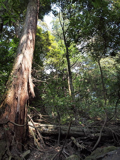
Hiking in bear country

Safety picks and trail essentials, top-rated on Amazon and Rakuten.

Nearby Incidents

Official

Yamazoe Nishihata, Nara

4.1 km

7 months ago

Uda Murou-Kamikasama, Nara
Official

Uda Murou-Kamikasama, Nara

4.3 km

1 month ago

Uda Murou-Kamikasama, Nara
Official

Uda Murou-Kamikasama, Nara

4.3 km

1 month ago

Official

Yamazoe Nakanosho, Nara

4.5 km

1 year ago

Official

Yamazoe Hirose, Nara

4.6 km

1 year ago

Official

Yamazoe Nishihata, Nara

4.8 km

7 months ago

Official

Nabari 梅が丘北一番町, Mie

4.8 km

1 year ago

Official

Yamazoe Oshio, Nara

4.9 km

7 months ago

Official

Yamazoe Nishihata, Nara

4.1 km

7 months ago

Uda Murou-Kamikasama, Nara
Official

Uda Murou-Kamikasama, Nara

4.3 km

1 month ago

Uda Murou-Kamikasama, Nara
Official

Uda Murou-Kamikasama, Nara

4.3 km

1 month ago

Official

Yamazoe Nakanosho, Nara

4.5 km

1 year ago

Official

Yamazoe Hirose, Nara

4.6 km

1 year ago

Official

Yamazoe Nishihata, Nara

4.8 km

7 months ago

Official

Nabari 梅が丘北一番町, Mie

4.8 km

1 year ago

Official

Yamazoe Oshio, Nara

4.9 km

7 months ago

Kumamap Kumamap

Track bear incidents across Japan. Stay safe outdoors.

Explore

Map Account Areas Places of Interest Predictions Near Me Trip Planner Trip Reports Community Alerts Gear

Learn

Bear Safety Guides Blog News Data FAQ

Mobile

iOS App Android App LINE WhatsApp

Company

About Contact Report Sponsor

Legal

Privacy Terms Commercial Disclosure
© 2026 Kumamap