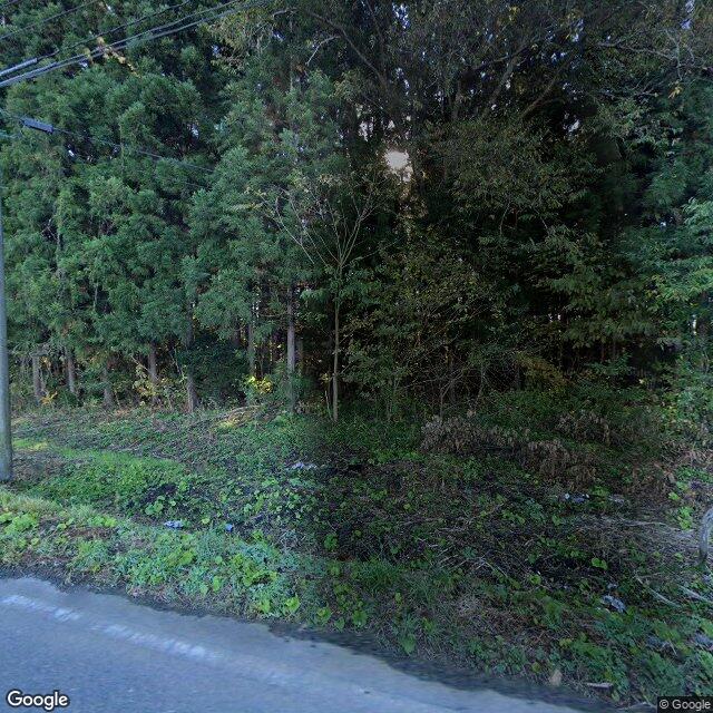
Kumamap Kumamap Kumamap
Map Areas Trip Planner Sponsor Alerts Report
English 日本語 한국어 简体中文 繁體中文 ไทย
Sign in
Sign in
Map Areas Trip Planner Sponsor Alerts Report
English 日本語 한국어 简体中文 繁體中文 ไทย
  1. Home
  2. Aomori
  3. Sannohe
  4. Sannohe Toyokawa
Incident photo 1

Official Black Bear Sannohe Toyokawa, Aomori May 30, 2026, 11:50 PM

0 views
Saw one too? Report it

Location

Description

A bear just under 1 meter in length crossed the road and went into the mountain to the south.

Note: Official sources provide information in Japanese only. This description has been machine translated for your convenience.

Bear Type

Black Bear

Number of Bears

1

Provider Type

Official

Date & Time

Saturday, May 30, 2026 at 11:50 PM

Address

Sannohe Toyokawa, Aomori

Coordinates

40.351616, 141.218696

Sources

https://kumalog-aomori.info/sightings

Related Areas

Aomori
Very High Risk

Aomori

8,608 incidents

Kunohe Castle
Low Risk

Kunohe Castle

Iwate

288 incidents

Sannohe
Low Risk

Sannohe

Aomori

170 incidents

Aomori
Very High Risk

Aomori

8,608 incidents

Kunohe Castle
Low Risk

Kunohe Castle

Iwate

288 incidents

Sannohe
Low Risk

Sannohe

Aomori

170 incidents

Nearby places of interest

School 1.2 km

Sannohe Chouritsu To Kawa Shougakkou

三戸町立斗川小学校

Aomori ·25 incidents

Mountain 3.8 km

No Sakai Yama

野境山

Iwate ·48 incidents

School 1.2 km

Sannohe Chouritsu To Kawa Shougakkou

三戸町立斗川小学校

Aomori ·25 incidents

Mountain 3.8 km

No Sakai Yama

野境山

Iwate ·48 incidents

Comments (0)

0/2000

No comments yet.

Plan Your Trip Risk Map

Hiking in bear country

Safety picks and trail essentials, top-rated on Amazon and Rakuten.

Nearby Incidents

Official

Sannohe, Aomori

540 m

7 years ago

Official

Sannohe Toyokawa, Aomori

561 m

2 years ago

Official

Sannohe Tonai, Aomori

631 m

7 months ago

Official

Sannohe Tonai, Aomori

640 m

8 months ago

Sannohe Tonai, Aomori
Official

Sannohe Tonai, Aomori

667 m

7 months ago

Official

Sannohe Toyokawa, Aomori

682 m

1 year ago

Official

Sannohe Tonai, Aomori

1.1 km

2 months ago

Tounai Aramaki district, Sannohe Town, Aomori
News

Tounai Aramaki district, Sannohe Town, Aomori

1.2 km

6 months ago

Official

Sannohe, Aomori

540 m

7 years ago

Official

Sannohe Toyokawa, Aomori

561 m

2 years ago

Official

Sannohe Tonai, Aomori

631 m

7 months ago

Official

Sannohe Tonai, Aomori

640 m

8 months ago

Sannohe Tonai, Aomori
Official

Sannohe Tonai, Aomori

667 m

7 months ago

Official

Sannohe Toyokawa, Aomori

682 m

1 year ago

Official

Sannohe Tonai, Aomori

1.1 km

2 months ago

Tounai Aramaki district, Sannohe Town, Aomori
News

Tounai Aramaki district, Sannohe Town, Aomori

1.2 km

6 months ago

Kumamap Kumamap

Track bear incidents across Japan. Stay safe outdoors.

Explore

Map Account Areas Places of Interest Predictions Near Me Trip Planner Trip Reports Community Alerts Gear

Learn

Bear Safety Guides Blog News Data FAQ

Mobile

iOS App Android App LINE WhatsApp

Company

About Contact Report Sponsor

Legal

Privacy Terms Commercial Disclosure
© 2026 Kumamap