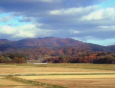
Kumamap Kumamap Kumamap
Map Areas Trip Planner Sponsor Alerts Report
English 日本語 한국어 简体中文 繁體中文 ไทย
Sign in
Sign in
Map Areas Trip Planner Sponsor Alerts Report
English 日本語 한국어 简体中文 繁體中文 ไทย
  1. Home
  2. Aomori
  3. Goshogawara
  4. Goshogawara 大字豊成

Official Black Bear Goshogawara 大字豊成, Aomori Jun 2, 2026, 10:50 PM

0 views
Saw one too? Report it

Location

Description

A member of the public spotted one bear while doing farm work.

Note: Official sources provide information in Japanese only. This description has been machine translated for your convenience.

Bear Type

Black Bear

Number of Bears

1

Provider Type

Official

Date & Time

Tuesday, June 2, 2026 at 10:50 PM

Address

Goshogawara 大字豊成, Aomori

Coordinates

40.775550, 140.517852

Sources

https://kumalog-aomori.info/sightings

Related Areas

Aomori
Very High Risk

Aomori

8,553 incidents

Ōmori Katsuyama Site
Moderate Risk

Ōmori Katsuyama Site

Aomori

953 incidents

Namioka Castle
High Risk

Namioka Castle

Aomori

917 incidents

Aomori Museum of Art
Moderate Risk

Aomori Museum of Art

Aomori

851 incidents

Sannai-Maruyama Site
Moderate Risk

Sannai-Maruyama Site

Aomori

839 incidents

Mount Bonju
Moderate Risk

Mount Bonju

Aomori

356 incidents

Osamu Dazai Memorial Museum
Low Risk

Osamu Dazai Memorial Museum

Aomori

169 incidents

Goshogawara
Low Risk

Goshogawara

Aomori

122 incidents

Aomori
Very High Risk

Aomori

8,553 incidents

Ōmori Katsuyama Site
Moderate Risk

Ōmori Katsuyama Site

Aomori

953 incidents

Namioka Castle
High Risk

Namioka Castle

Aomori

917 incidents

Aomori Museum of Art
Moderate Risk

Aomori Museum of Art

Aomori

851 incidents

Sannai-Maruyama Site
Moderate Risk

Sannai-Maruyama Site

Aomori

839 incidents

Mount Bonju
Moderate Risk

Mount Bonju

Aomori

356 incidents

Osamu Dazai Memorial Museum
Low Risk

Osamu Dazai Memorial Museum

Aomori

169 incidents

Goshogawara
Low Risk

Goshogawara

Aomori

122 incidents

Nearby places of interest

Campground 937 m

Yama No Etsu Ko Minka

山の越 古民家

Aomori ·26 incidents

School 1.4 km

Goshogawara Shiritsu Touhou Shougakkou

五所川原市立東峰小学校

Aomori ·17 incidents

Mountain 2.7 km

Mata Hakusan

又白山

Aomori ·65 incidents

Mountain 3.7 km

Chouja Moriyama

長者森山

Aomori ·56 incidents

Mountain 4.8 km

Kanetsuki Douyama

鐘撞堂山

Aomori ·110 incidents

Comments (0)

0/2000

No comments yet.

Plan Your Trip Risk Map

Hiking in bear country

Safety picks and trail essentials, top-rated on Amazon and Rakuten.

Nearby Incidents

Official

Goshogawara 大字豊成, Aomori

634 m

8 months ago

Official

Goshogawara 大字豊成, Aomori

768 m

11 months ago

Official

Goshogawara 大字原子, Aomori

821 m

7 months ago

Official

Goshogawara 大字原子, Aomori

822 m

10 months ago

Official

Goshogawara 大字野里, Aomori

826 m

9 months ago

Official

Goshogawara 大字豊成, Aomori

908 m

9 months ago

Official

Goshogawara 大字野里, Aomori

1.0 km

8 months ago

Official

Goshogawara 大字豊成, Aomori

1.1 km

3 weeks ago

Official

Goshogawara 大字豊成, Aomori

634 m

8 months ago

Official

Goshogawara 大字豊成, Aomori

768 m

11 months ago

Official

Goshogawara 大字原子, Aomori

821 m

7 months ago

Official

Goshogawara 大字原子, Aomori

822 m

10 months ago

Official

Goshogawara 大字野里, Aomori

826 m

9 months ago

Official

Goshogawara 大字豊成, Aomori

908 m

9 months ago

Official

Goshogawara 大字野里, Aomori

1.0 km

8 months ago

Official

Goshogawara 大字豊成, Aomori

1.1 km

3 weeks ago

Kumamap Kumamap

Track bear incidents across Japan. Stay safe outdoors.

Explore

Map Account Areas Places of Interest Predictions Near Me Trip Planner Trip Reports Community Alerts Gear

Learn

Bear Safety Guides Blog News Data FAQ

Mobile

iOS App Android App LINE WhatsApp

Company

About Contact Report Sponsor

Legal

Privacy Terms Commercial Disclosure
© 2026 Kumamap