
Kumamap Kumamap Kumamap
Map Areas Trip Planner Sponsor Alerts Report
English 日本語 한국어 简体中文 繁體中文 ไทย
Sign in
Sign in
Map Areas Trip Planner Sponsor Alerts Report
English 日本語 한국어 简体中文 繁體中文 ไทย
  1. Home
  2. Trip Planner
  3. Trip Reports
  4. Mount Kashimayari to Jiigatake Hiking Route

Mount Kashimayari to Jiigatake Hiking Route

Hiking · High Risk · 4.8 km · 1h 15m · 2 stops · 10 sightings · Saved July 9, 2026 · Last updated 1 hour ago
Customize this trip

Saves as a new trip plan. The original stays as-is.

0 views
2
Incidents in last 7 days
10
Incidents in last 30 days
22 hours ago
Latest

Safety Summary

This 4.8 km route runs from Mount Kashimayari to Jiigatake, passing through Nagano and Toyama. In the past 30 days, 10 bear sightings were reported within 5 km of the route. The past 7 days account for 2 of them. The latest sighting was reported 22 hours ago near Ōmachi, Nagano.

At this density of recent sightings, consider rescheduling or choosing a different trail until activity quiets.

Your Route

Route Profile

Highlights Along Your Route (2)

2 places within 1 km of your route, passing through Nagano, Toyama.

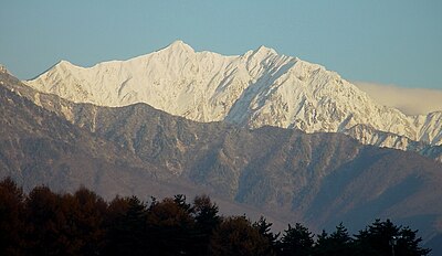
Mount Kashimayari
Moderate Risk

Mount Kashimayari

Nagano

299 incidents

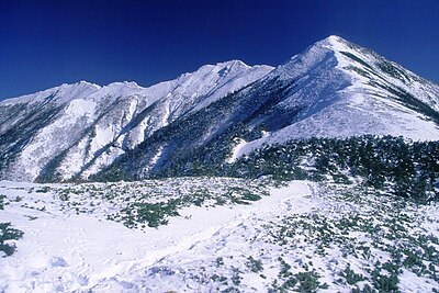
Jiigatake
Moderate Risk

Jiigatake

Nagano

365 incidents

Mount Kashimayari
Moderate Risk

Mount Kashimayari

Nagano

299 incidents

Jiigatake
Moderate Risk

Jiigatake

Nagano

365 incidents

Route Timeline

|
S
Mount Kashimayari, Nagano
High Risk 4.8 km 1h 15m Includes steps 10 sightings within 5 km
Ōmachi, Nagano

Size: Unknown

Ōmachi, Nagano

Official ·22 hours ago

Size: adult (fully grown)

Ōmachi, Nagano

Official ·4 days ago

One bear appeared on the trail from Jii-ga-take toward Taneike Sanso. Some climbers turned back. Later the bear appeared on the descent route from Taneike Sanso toward Ogizawa. Descending was difficult, but Taneike Sanso staff drove the bear away. Those camping in tents were told by the Taneike Sanso staff to stop and instead stayed overnight in the mountain hut.

Ōmachi, Nagano

1 week ago
Show 7 more
Ōmachi, Nagano

Size: Adult

Ōmachi, Nagano

Official ·2 weeks ago
Ōmachi, Nagano

Around 9:15 AM on 2026-07-06, a bear was sighted in Taira, Omachi City, Nagano Prefecture.

Ōmachi, Nagano

News ·3 weeks ago
Ōmachi, Nagano

A bear was sighted in Taira, Omachi City, around 8:20 PM on 2026-07-04.

Ōmachi, Nagano

News ·3 weeks ago
Ōmachi, Nagano

A bear was sighted in Taira, Omachi City, Nagano, around 8:20 AM on June 29.

Ōmachi, Nagano

News ·1 month ago
Ōmachi, Nagano

Size: Adult (fully grown)

Ōmachi, Nagano

Official ·1 month ago
Ōmachi, Nagano

A bear was sighted in Taira, Omachi City, on the afternoon of 2026-06-28.

Ōmachi, Nagano

News ·1 month ago
Ōmachi, Nagano

Size: Adult

Ōmachi, Nagano

Official ·1 month ago
G
Jiigatake, Nagano
Total Distance: 4.8 km

When Are Bears Most Active?

Peak activity at 8:00 with 1 incidents

Asian black bears on your route

Asian Black Bear

Asian Black Bear

Ursus thibetanus japonicus

Range
Honshu, Shikoku
Size
80–120 kg
Active
Dawn & dusk

Sharing space safely

  • ·Make noise as you walk; carry bear spray
  • ·If charged, stand firm and use the spray
  • ·If contact happens, resist firmly. They retreat when met with resistance
  • ·Don't climb. They climb better than you

Safety Checklist

Hiking in bear country

Safety picks and trail essentials, top-rated on Amazon and Rakuten.

Emergency Contacts

110
Police
119
Fire/Ambulance

For mountain rescue, call 110 (police). They will coordinate with local rescue teams.

Bear risk analysis map showing route with safety levels

Like what you see? Plan your own.

Draw any route in Japan and get the same bear-safety report, built around the trip you're actually taking.

  • Same incident database powering this report
  • Risk forecast tuned to your exact route
  • Free, instant, no sign-up
Plan my route Browse more trips

Comments (0)

0/2000

No comments yet.

Frequently Asked Questions About This Route

How many bear sightings are on this route?

In the past 30 days, 10 bear sightings were reported within 5 km of the route. The past 7 days account for 2 of them.

When and where was the most recent bear sighting near this route?

The latest sighting was reported 22 hours ago near Ōmachi, Nagano.

What time of day are bears most active here?

Recent sightings on this route peak around 8:00. Bears are generally most active at dawn and dusk.

Is this route safe to travel right now?

This 4.8 km route runs from Mount Kashimayari to Jiigatake, passing through Nagano and Toyama. In the past 30 days, 10 bear sightings were reported within 5 km of the route. The past 7 days account for 2 of them. The latest sighting was reported 22 hours ago near Ōmachi, Nagano. At this density of recent sightings, consider rescheduling or choosing a different trail until activity quiets.

Back to Trip Reports
Kumamap Kumamap

Track bear incidents across Japan. Stay safe outdoors.

Explore

Map Account Areas Places of Interest Predictions Near Me Trip Planner Trip Reports Community Alerts Gear

Learn

Bear Safety Guides Blog News Data FAQ

Mobile

iOS App Android App LINE WhatsApp

Company

About Contact Report Sponsor

Legal

Privacy Terms Commercial Disclosure
Sponsor
mistweaverco.com mistweaverco.com
© 2026 Kumamap