Kumamap Kumamap Kumamap
Map Areas Trip Planner Sponsor Alerts Report
English 日本語 한국어 简体中文 繁體中文 ไทย
Sign in
Sign in
Map Areas Trip Planner Sponsor Alerts Report
English 日本語 한국어 简体中文 繁體中文 ไทย
  1. Home
  2. Gunma
  3. Nammoku
  4. Nanmoku Mukuruma
Incident photo 1

Official Black Bear Nanmoku Mukuruma, Gunma Jun 1, 2026, 10:00 PM

0 views
Saw one too? Report it

Location

Description

No description provided

Bear Type

Black Bear

Number of Bears

1

Provider Type

Official

Date & Time

Monday, June 1, 2026 at 10:00 PM

Address

Nanmoku Mukuruma, Gunma

Coordinates

36.159133, 138.695972

Sources

https://pref-gunma.maps.arcgis.com/apps/dashboards/5276d2ebf...

Related Areas

Gunma
High Risk

Gunma

1,550 incidents

Nakanotake Shrine
Moderate Risk

Nakanotake Shrine

Gunma

362 incidents

Myōgi-Arafune-Saku Kōgen Quasi-National Park
Moderate Risk

Myōgi-Arafune-Saku Kōgen Quasi-National Park

Gunma

204 incidents

Tatsuoka Castle
Low Risk

Tatsuoka Castle

Nagano

152 incidents

Mount Arafune
Low Risk

Mount Arafune

Gunma

86 incidents

Nammoku
Low Risk

Nammoku

Gunma

15 incidents

Gunma
High Risk

Gunma

1,550 incidents

Nakanotake Shrine
Moderate Risk

Nakanotake Shrine

Gunma

362 incidents

Myōgi-Arafune-Saku Kōgen Quasi-National Park
Moderate Risk

Myōgi-Arafune-Saku Kōgen Quasi-National Park

Gunma

204 incidents

Tatsuoka Castle
Low Risk

Tatsuoka Castle

Nagano

152 incidents

Mount Arafune
Low Risk

Mount Arafune

Gunma

86 incidents

Nammoku
Low Risk

Nammoku

Gunma

15 incidents

Nearby places of interest

School 1.1 km

Nanmoku Sonritsu Nanmoku Chuugakkou

南牧村立 南牧中学校

Gunma ·6 incidents

Mountain 1.8 km

Mt. Fuji-Asama

Gunma ·15 incidents

Mountain 2.2 km

San Tsu Iwadake

三ッ岩岳

Gunma ·9 incidents

Mountain 3.1 km

Ooya Yama

大屋山

Gunma ·8 incidents

Mountain 3.3 km

Ootsu

大津

Gunma ·8 incidents

Mountain 3.4 km

Kurotaki Yama

黒滝山

Gunma ·15 incidents

Mountain 3.5 km

Mt. Eboshi

Gunma ·8 incidents

Comments (0)

0/2000

No comments yet.

Plan Your Trip Risk Map

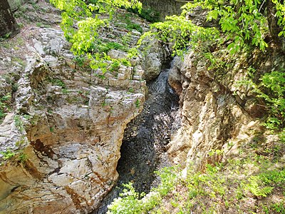
Hiking in bear country

Safety picks and trail essentials, top-rated on Amazon and Rakuten.

Nearby Incidents

Official

Nanmoku Mukuruma, Gunma

266 m

2 years ago

Official

Nanmoku Ohinata, Gunma

1.3 km

3 days ago

Nanmoku Ohinata, Gunma
Official

Nanmoku Ohinata, Gunma

1.7 km

2 days ago

Nanmoku Ohinata, Gunma
Official

Nanmoku Ohinata, Gunma

1.7 km

6 days ago

Nanmoku Ohinata, Gunma
Official

Nanmoku Ohinata, Gunma

1.8 km

3 days ago

Official

Tozawa, Gunma

2.0 km

2 years ago

Tozawa, Gunma
Official

Tozawa, Gunma

2.1 km

1 week ago

Official

Iwado, Gunma

2.9 km

2 years ago

Official

Nanmoku Mukuruma, Gunma

266 m

2 years ago

Official

Nanmoku Ohinata, Gunma

1.3 km

3 days ago

Nanmoku Ohinata, Gunma
Official

Nanmoku Ohinata, Gunma

1.7 km

2 days ago

Nanmoku Ohinata, Gunma
Official

Nanmoku Ohinata, Gunma

1.7 km

6 days ago

Nanmoku Ohinata, Gunma
Official

Nanmoku Ohinata, Gunma

1.8 km

3 days ago

Official

Tozawa, Gunma

2.0 km

2 years ago

Tozawa, Gunma
Official

Tozawa, Gunma

2.1 km

1 week ago

Official

Iwado, Gunma

2.9 km

2 years ago

Kumamap Kumamap

Track bear incidents across Japan. Stay safe outdoors.

Explore

Map Account Areas Places of Interest Predictions Near Me Trip Planner Trip Reports Community Alerts Gear

Learn

Bear Safety Guides Blog News Data FAQ

Mobile

iOS App Android App LINE WhatsApp

Company

About Contact Report Sponsor

Legal

Privacy Terms Commercial Disclosure
© 2026 Kumamap