Kumamap Kumamap Kumamap
Map Areas Trip Planner Sponsor Alerts Report
English 日本語 한국어 简体中文 繁體中文 ไทย
Sign in
Sign in
Map Areas Trip Planner Sponsor Alerts Report
English 日本語 한국어 简体中文 繁體中文 ไทย
  1. Home
  2. Shimane
  3. Misato
  4. Misato 鈩谷
Incident photo 1

Official Black Bear Misato 鈩谷, Shimane Dec 6, 2025, 09:15 AM

0 views
Saw one too? Report it

Location

Description

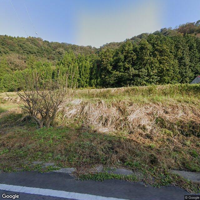
Around 9:15 a.m. on December 6, 2025, near a medical clinic in Misato Town, Shimane Prefecture, one adult bear about 1 meter long.

Note: Official sources provide information in Japanese only. This description has been machine translated for your convenience.

Bear Type

Black Bear

Number of Bears

1

Provider Type

Official

Date & Time

Saturday, December 6, 2025 at 09:15 AM

Address

Misato 鈩谷, Shimane

Coordinates

35.051756, 132.656530

Sources

https://www.google.com/maps/d/u/0/viewer?mid=1g5S_PUzzPjzY5U...

Related Areas

Shimane
Very High Risk

Shimane

788 incidents

Mount Sanbe
Low Risk

Mount Sanbe

Shimane

40 incidents

Misato
Low Risk

Misato

Shimane

22 incidents

Shimane
Very High Risk

Shimane

788 incidents

Mount Sanbe
Low Risk

Mount Sanbe

Shimane

40 incidents

Misato
Low Risk

Misato

Shimane

22 incidents

Nearby places of interest

Kindergarten 197 m

Shakaifukushi Houjin Ouchi Kai Ryuutaku Yaho Iku Tokoro

社会福祉法人邑智会立沢谷保育所

Shimane ·2 incidents

Mountain 4.3 km

Juuman Yama

充満山

Shimane ·18 incidents

Kindergarten 197 m

Shakaifukushi Houjin Ouchi Kai Ryuutaku Yaho Iku Tokoro

社会福祉法人邑智会立沢谷保育所

Shimane ·2 incidents

Mountain 4.3 km

Juuman Yama

充満山

Shimane ·18 incidents

Comments (1)

0/2000

Lorelei NeutralLisa Wischofskyhttps://www.figma.com/community/file/1198749693280469639https://creativecommons.org/publicdomain/zero/1.0/Remix of „Lorelei Neutral” (https://www.figma.com/community/file/1198749693280469639) by „Lisa Wischofsky”, licensed under „CC0 1.0” (https://creativecommons.org/publicdomain/zero/1.0/)
Satoshi 6 months ago

A bear that size wandering past a medical clinic in broad daylight says something about how much the residential boundaries have shifted here.

Plan Your Trip Risk Map

Hiking in bear country

Safety picks and trail essentials, top-rated on Amazon and Rakuten.

Nearby Incidents

Official

Misato 原, Shimane

1.3 km

7 months ago

News

Ochiai Bridge (Chihara, Misato Town), Shimane

2.4 km

7 months ago

Official

Misato 花ノ谷, Shimane

3.0 km

1 year ago

News

Kunokaichi, Misato Town, Shimane

3.2 km

6 months ago

Official

Misato Kamikawado, Shimane

4.1 km

7 months ago

Official

Misato Ushiomura, Shimane

4.2 km

6 months ago

Official

Misato Sakedani, Shimane

4.4 km

7 months ago

Official

Misato 本久保, Shimane

5.1 km

1 year ago

Official

Misato 原, Shimane

1.3 km

7 months ago

News

Ochiai Bridge (Chihara, Misato Town), Shimane

2.4 km

7 months ago

Official

Misato 花ノ谷, Shimane

3.0 km

1 year ago

News

Kunokaichi, Misato Town, Shimane

3.2 km

6 months ago

Official

Misato Kamikawado, Shimane

4.1 km

7 months ago

Official

Misato Ushiomura, Shimane

4.2 km

6 months ago

Official

Misato Sakedani, Shimane

4.4 km

7 months ago

Official

Misato 本久保, Shimane

5.1 km

1 year ago

Kumamap Kumamap

Track bear incidents across Japan. Stay safe outdoors.

Explore

Map Account Areas Places of Interest Predictions Near Me Trip Planner Trip Reports Community Alerts Gear

Learn

Bear Safety Guides Blog News Data FAQ

Mobile

iOS App Android App LINE WhatsApp

Company

About Contact Report Sponsor

Legal

Privacy Terms Commercial Disclosure
© 2026 Kumamap