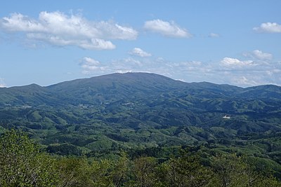
Kumamap Kumamap Kumamap
Map Areas Trip Planner Sponsor Alerts Report
English 日本語 한국어 简体中文 繁體中文 ไทย
Sign in
Sign in
Map Areas Trip Planner Sponsor Alerts Report
English 日本語 한국어 简体中文 繁體中文 ไทย
  1. Home
  2. Fukushima
  3. Ono
  4. Ono Iitoyo

Official Black Bear Ono Iitoyo, Fukushima May 19, 2026, 01:00 PM

0 views
Saw one too? Report it

Location

Description

On Tuesday, May 19 at around 10:00 PM, a male witness sighted one animal believed to be a bear (approximately 1.5 m in length) on a town road in Nagakubo, Iide, Ono-machi. The bear then departed into the woodland to the east.

Note: Official sources provide information in Japanese only. This description has been machine translated for your convenience.

Bear Type

Black Bear

Number of Bears

1

Provider Type

Official

Date & Time

Tuesday, May 19, 2026 at 01:00 PM

Address

Ono Iitoyo, Fukushima

Coordinates

37.331157, 140.626348

Sources

https://www.rfc.jp/spe/kuma/

Related Areas

Fukushima
Very High Risk

Fukushima

5,892 incidents

DaiTakine yama
Low Risk

DaiTakine yama

Fukushima

13 incidents

Ono
Low Risk

Ono

Fukushima

5 incidents

Fukushima
Very High Risk

Fukushima

5,892 incidents

DaiTakine yama
Low Risk

DaiTakine yama

Fukushima

13 incidents

Ono
Low Risk

Ono

Fukushima

5 incidents

Nearby places of interest

Mountain 4.7 km

Sendai Taira

仙台平

Fukushima ·5 incidents

Mountain 4.7 km

Toudou Yama

東堂山

Fukushima ·9 incidents

Mountain 4.7 km

Taka Shibayama

高柴山

Fukushima ·6 incidents

Mountain 5.0 km

Nichiei Yama

日影山

Fukushima ·8 incidents

Mountain 4.7 km

Sendai Taira

仙台平

Fukushima ·5 incidents

Mountain 4.7 km

Toudou Yama

東堂山

Fukushima ·9 incidents

Mountain 4.7 km

Taka Shibayama

高柴山

Fukushima ·6 incidents

Mountain 5.0 km

Nichiei Yama

日影山

Fukushima ·8 incidents

Comments (0)

0/2000

No comments yet.

Plan Your Trip Risk Map

Hiking in bear country

Safety picks and trail essentials, top-rated on Amazon and Rakuten.

Nearby Incidents

News

Ono Iitoyo, Fukushima

403 m

3 weeks ago

Official

Tamura Takinemachi-Sugaya, Fukushima

2.5 km

3 weeks ago

Official

Tamura Ogoemachi-Kuride, Fukushima

2.9 km

3 weeks ago

Official

Tamura Ogoemachi-Kuride, Fukushima

3.6 km

3 weeks ago

Official

Ono Shobuya, Fukushima

6.5 km

1 year ago

Official

Tamura, Fukushima

6.7 km

3 years ago

Official

Tamura, Fukushima

6.7 km

3 years ago

Official

Tamura Funehikimachi-Kunugiyama, Fukushima

7.1 km

1 month ago

Kumamap Kumamap

Track bear incidents across Japan. Stay safe outdoors.

Explore

Map Account Areas Places of Interest Predictions Near Me Trip Planner Trip Reports Community Alerts Gear

Learn

Bear Safety Guides Blog News Data FAQ

Mobile

iOS App Android App LINE WhatsApp

Company

About Contact Report Sponsor

Legal

Privacy Terms Commercial Disclosure
© 2026 Kumamap