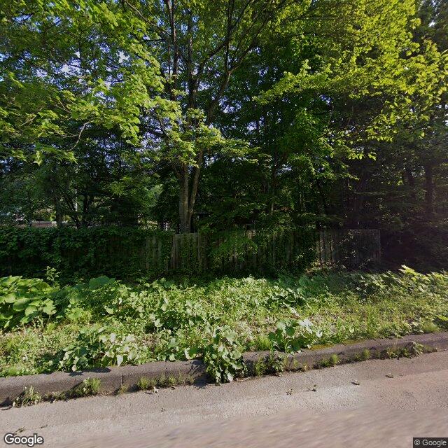
Kumamap Kumamap Kumamap
Map Areas Trip Planner Sponsor Alerts Report
English 日本語 한국어 简体中文 繁體中文 ไทย
Sign in
Sign in
Map Areas Trip Planner Sponsor Alerts Report
English 日本語 한국어 简体中文 繁體中文 ไทย
  1. Home
  2. Aomori
  3. Shichinohe
  4. Shichinohe 志茂川原
Incident photo 1

Official Black Bear Shichinohe 志茂川原, Aomori Jun 13, 2026, 02:05 AM

0 views
Saw one too? Report it

Location

Description

While driving, I saw one bear about the size of an adult cross the road from south to north and enter the forest.

Note: Official sources provide information in Japanese only. This description has been machine translated for your convenience.

Bear Type

Black Bear

Number of Bears

1

Provider Type

Official

Date & Time

Saturday, June 13, 2026 at 02:05 AM

Address

Shichinohe 志茂川原, Aomori

Coordinates

40.791067, 141.092982

Sources

https://kumalog-aomori.info/sightings

Related Areas

Aomori
Very High Risk

Aomori

8,553 incidents

Shichinohe
Low Risk

Shichinohe

Aomori

212 incidents

Aomori
Very High Risk

Aomori

8,553 incidents

Shichinohe
Low Risk

Shichinohe

Aomori

212 incidents

Nearby places of interest

Mountain 2.9 km

Soga Mori

曽我森

Aomori ·14 incidents

Mountain 3.8 km

Takamori Yama

高森山

Aomori ·8 incidents

Mountain 4.1 km

Hanbee Takamori

半兵衛高森

Aomori ·7 incidents

Mountain 2.9 km

Soga Mori

曽我森

Aomori ·14 incidents

Mountain 3.8 km

Takamori Yama

高森山

Aomori ·8 incidents

Mountain 4.1 km

Hanbee Takamori

半兵衛高森

Aomori ·7 incidents

Comments (0)

0/2000

No comments yet.

Plan Your Trip Risk Map

Hiking in bear country

Safety picks and trail essentials, top-rated on Amazon and Rakuten.

Nearby Incidents

Official

Shichinohe 志茂川原, Aomori

29 m

6 years ago

Official

Shichinohe 志茂川原, Aomori

37 m

6 years ago

Official

Shichinohe 志茂川原, Aomori

512 m

7 years ago

Official

Shichinohe 上志多, Aomori

1.3 km

7 years ago

Official

Shichinohe, Aomori

1.7 km

6 years ago

Official

Shichinohe 下志多, Aomori

2.2 km

10 months ago

Official

Tohoku 宇道坂, Aomori

2.8 km

8 years ago

Official

Tohoku 上板橋家ノ後, Aomori

3.1 km

3 years ago

Official

Shichinohe 志茂川原, Aomori

29 m

6 years ago

Official

Shichinohe 志茂川原, Aomori

37 m

6 years ago

Official

Shichinohe 志茂川原, Aomori

512 m

7 years ago

Official

Shichinohe 上志多, Aomori

1.3 km

7 years ago

Official

Shichinohe, Aomori

1.7 km

6 years ago

Official

Shichinohe 下志多, Aomori

2.2 km

10 months ago

Official

Tohoku 宇道坂, Aomori

2.8 km

8 years ago

Official

Tohoku 上板橋家ノ後, Aomori

3.1 km

3 years ago

Kumamap Kumamap

Track bear incidents across Japan. Stay safe outdoors.

Explore

Map Account Areas Places of Interest Predictions Near Me Trip Planner Trip Reports Community Alerts Gear

Learn

Bear Safety Guides Blog News Data FAQ

Mobile

iOS App Android App LINE WhatsApp

Company

About Contact Report Sponsor

Legal

Privacy Terms Commercial Disclosure
© 2026 Kumamap