Kumamap Kumamap Kumamap
Map Areas Trip Planner Sponsor Alerts Report
English 日本語 한국어 简体中文 繁體中文 ไทย
Sign in
Sign in
Map Areas Trip Planner Sponsor Alerts Report
English 日本語 한국어 简体中文 繁體中文 ไทย
  1. Home
  2. Nagano
  3. Saku

Official Black Bear Saku, Nagano Sep 24, 2025

0 views
Saw one too? Report it

Location

Description

Size: unknown

Note: Official sources provide information in Japanese only. This description has been machine translated for your convenience.

Bear Type

Black Bear

Number of Bears

1

Provider Type

Official

Date & Time

Wednesday, September 24, 2025

Address

Saku, Nagano

Coordinates

36.214796, 138.610677

Sources

https://v2.kemonote.com

Related Areas

Nagano
Very High Risk

Nagano

4,052 incidents

Usui Pass Railway Heritage Park
Moderate Risk

Usui Pass Railway Heritage Park

Gunma

425 incidents

Nakanotake Shrine
Moderate Risk

Nakanotake Shrine

Gunma

365 incidents

An'yō-ji Temple
Moderate Risk

An'yō-ji Temple

Nagano

306 incidents

Myōgi-Arafune-Saku Kōgen Quasi-National Park
Moderate Risk

Myōgi-Arafune-Saku Kōgen Quasi-National Park

Gunma

206 incidents

Tatsuoka Castle
Low Risk

Tatsuoka Castle

Nagano

152 incidents

Mount Arafune
Low Risk

Mount Arafune

Gunma

87 incidents

Saku
Low Risk

Saku

Nagano

34 incidents

Nagano
Very High Risk

Nagano

4,052 incidents

Usui Pass Railway Heritage Park
Moderate Risk

Usui Pass Railway Heritage Park

Gunma

425 incidents

Nakanotake Shrine
Moderate Risk

Nakanotake Shrine

Gunma

365 incidents

An'yō-ji Temple
Moderate Risk

An'yō-ji Temple

Nagano

306 incidents

Myōgi-Arafune-Saku Kōgen Quasi-National Park
Moderate Risk

Myōgi-Arafune-Saku Kōgen Quasi-National Park

Gunma

206 incidents

Tatsuoka Castle
Low Risk

Tatsuoka Castle

Nagano

152 incidents

Mount Arafune
Low Risk

Mount Arafune

Gunma

87 incidents

Saku
Low Risk

Saku

Nagano

34 incidents

Nearby places of interest
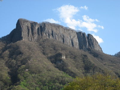
Mountain 1.4 km

Mt. Kumakura

Gunma ·21 incidents

Mountain 1.8 km

Mt. Kabutoiwa

Nagano ·13 incidents

Mountain 2.7 km

Mt. Arafune

Gunma ·15 incidents

Mountain 3.6 km

Tako No Mine

凧の峰

Nagano ·24 incidents

Mountain 3.7 km

Monomi Yama

物見山

Gunma ·27 incidents

Mountain 3.8 km

Ryouzen Mine

霊仙峰

Nagano ·3 incidents

Mountain 4.3 km

Tateiwa

立岩

Gunma ·5 incidents

Comments (0)

0/2000

No comments yet.

Plan Your Trip Risk Map

Hiking in bear country

Safety picks and trail essentials, top-rated on Amazon and Rakuten.

Nearby Incidents

Official

Saku, Nagano

1.7 km

11 months ago

Official

Saku, Nagano

2.0 km

2 years ago

Community

Shimonita, Gunma

2.0 km

1 month ago

Community

Shimonita, Gunma

2.0 km

1 month ago

Official

Saku, Nagano

2.8 km

1 year ago

Official

Saku, Nagano

2.8 km

1 year ago

Official

Saku, Nagano

2.8 km

1 year ago

Official

Saku, Nagano

2.8 km

1 year ago

Official

Saku, Nagano

1.7 km

11 months ago

Official

Saku, Nagano

2.0 km

2 years ago

Community

Shimonita, Gunma

2.0 km

1 month ago

Community

Shimonita, Gunma

2.0 km

1 month ago

Official

Saku, Nagano

2.8 km

1 year ago

Official

Saku, Nagano

2.8 km

1 year ago

Official

Saku, Nagano

2.8 km

1 year ago

Official

Saku, Nagano

2.8 km

1 year ago

Kumamap Kumamap

Track bear incidents across Japan. Stay safe outdoors.

Explore

Map Account Areas Places of Interest Predictions Near Me Trip Planner Trip Reports Community Alerts Gear

Learn

Bear Safety Guides Blog News Data FAQ

Mobile

iOS App Android App LINE WhatsApp

Company

About Contact Report Sponsor

Legal

Privacy Terms Commercial Disclosure
© 2026 Kumamap