Kumamap Kumamap Kumamap
Map Areas Trip Planner Sponsor Alerts Report
English 日本語 한국어 简体中文 繁體中文 ไทย
Sign in
Sign in
Map Areas Trip Planner Sponsor Alerts Report
English 日本語 한국어 简体中文 繁體中文 ไทย
  1. Home
  2. Toyama
  3. Tateyama
Incident photo 1

News Black Bear Tateyama, Toyama May 19, 2026, 03:00 PM

0 views
Saw one too? Report it

Location

Description

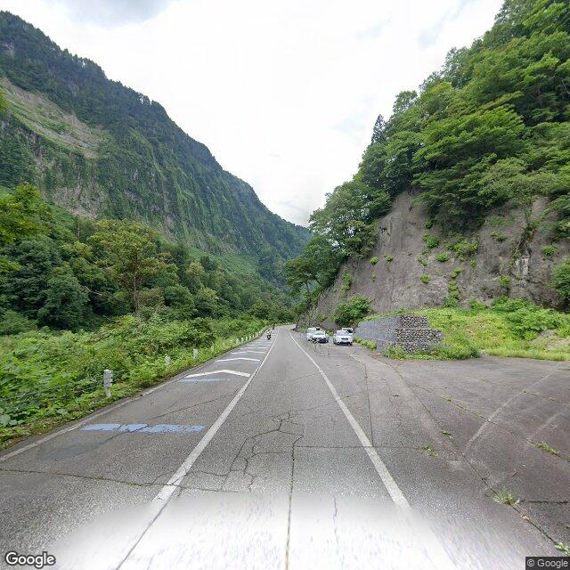
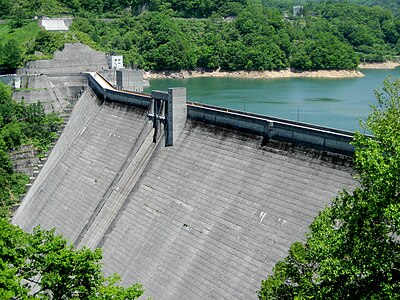
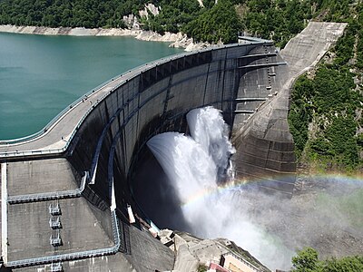
The so-called 'Shomyo Road' leading to Shomyo Falls in Tateyama Town, Toyama Prefecture, which had been closed after two tourists were attacked by a bear, was partially reopened on the 20th. A radio cassette player has been installed as a bear countermeasure, while the trail to Shomyo Falls remains closed and vigilance continues.

Note: Official sources provide information in Japanese only. This description has been machine translated for your convenience.

Summary

The 'Shomyo Road' to Shomyo Falls in Tateyama Town, Toyama Prefecture, which had been closed after two tourists were attacked by a bear, was partially reopened on the 20th. Authorities have installed a radio as a bear deterrent, but the trail to the falls remains closed and officials continue to monitor the area.

Bear Type

Black Bear

Number of Bears

1

Provider Type

News

Date & Time

Tuesday, May 19, 2026 at 03:00 PM

Address

Tateyama, Toyama

Coordinates

36.581603, 137.500882

Sources

https://article.auone.jp/detail/1/2/2/464_2_r_20260520_17792...

Related Areas

Toyama
High Risk

Toyama

9,255 incidents

Tateyama Caldera Sabo Museum
Moderate Risk

Tateyama Caldera Sabo Museum

Toyama

2,364 incidents

Tateyama
Moderate Risk

Tateyama

Toyama

1,299 incidents

Arimine Dam
Low Risk

Arimine Dam

Toyama

1,140 incidents

Mikurigaike
Low Risk

Mikurigaike

Toyama

530 incidents

Kurobe Dam
Low Risk

Kurobe Dam

Toyama

503 incidents

Jōganji River
Low Risk

Jōganji River

Toyama

398 incidents

Oku Dainichi take
Low Risk

Oku Dainichi take

Toyama

261 incidents

Toyama
High Risk

Toyama

9,255 incidents

Tateyama Caldera Sabo Museum
Moderate Risk

Tateyama Caldera Sabo Museum

Toyama

2,364 incidents

Tateyama
Moderate Risk

Tateyama

Toyama

1,299 incidents

Arimine Dam
Low Risk

Arimine Dam

Toyama

1,140 incidents

Mikurigaike
Low Risk

Mikurigaike

Toyama

530 incidents

Kurobe Dam
Low Risk

Kurobe Dam

Toyama

503 incidents

Jōganji River
Low Risk

Jōganji River

Toyama

398 incidents

Oku Dainichi take
Low Risk

Oku Dainichi take

Toyama

261 incidents

Comments (0)

0/2000

No comments yet.

Plan Your Trip Risk Map

Hiking in bear country

Safety picks and trail essentials, top-rated on Amazon and Rakuten.

Nearby Incidents

Official

Tateyama, Toyama

212 m

11 months ago

Official

Tateyama, Toyama

212 m

11 months ago

Official

Tateyama, Toyama

757 m

7 years ago

Official

Tateyama, Toyama

757 m

7 years ago

Official

Tateyama, Toyama

786 m

2 years ago

Official

Tateyama, Toyama

786 m

2 years ago

Official

Tateyama, Toyama

786 m

2 years ago

Official

Tateyama, Toyama

955 m

2 years ago

Official

Tateyama, Toyama

212 m

11 months ago

Official

Tateyama, Toyama

212 m

11 months ago

Official

Tateyama, Toyama

757 m

7 years ago

Official

Tateyama, Toyama

757 m

7 years ago

Official

Tateyama, Toyama

786 m

2 years ago

Official

Tateyama, Toyama

786 m

2 years ago

Official

Tateyama, Toyama

786 m

2 years ago

Official

Tateyama, Toyama

955 m

2 years ago

Kumamap Kumamap

Track bear incidents across Japan. Stay safe outdoors.

Explore

Map Account Areas Predictions Near Me Trip Planner Trip Reports Community Alerts Gear

Learn

Bear Safety Guides Blog News Data FAQ

Mobile

iOS App Android App LINE WhatsApp

Company

About Contact Report Sponsor

Legal

Privacy Terms Commercial Disclosure
© 2026 Kumamap