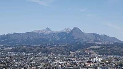
Kumamap Kumamap Kumamap
Map Areas Trip Planner Sponsor Alerts Report
English 日本語 한국어 简体中文 繁體中文 ไทย
Sign in
Sign in
Map Areas Trip Planner Sponsor Alerts Report
English 日本語 한국어 简体中文 繁體中文 ไทย
  1. Home
  2. Gunma
  3. Takasaki
  4. Takasaki 箕郷町中野

Official Black Bear Takasaki 箕郷町中野, Gunma Jun 22, 2024, 03:00 PM

0 views
Saw one too? Report it

Location

Description

No description provided

Bear Type

Black Bear

Number of Bears

1

Provider Type

Official

Date & Time

Saturday, June 22, 2024 at 03:00 PM

Address

Takasaki 箕郷町中野, Gunma

Coordinates

36.438749, 138.905268

Sources

https://pref-gunma.maps.arcgis.com/apps/dashboards/5276d2ebf...

Related Areas

Gunma
Very High Risk

Gunma

1,594 incidents

Minowa Castle
Moderate Risk

Minowa Castle

Gunma

249 incidents

Mount Haruna
Low Risk

Mount Haruna

Gunma

191 incidents

Gunma Prefectural Government Building
Low Risk

Gunma Prefectural Government Building

Gunma

150 incidents

Takasaki
Low Risk

Takasaki

Gunma

103 incidents

Gunma
Very High Risk

Gunma

1,594 incidents

Minowa Castle
Moderate Risk

Minowa Castle

Gunma

249 incidents

Mount Haruna
Low Risk

Mount Haruna

Gunma

191 incidents

Gunma Prefectural Government Building
Low Risk

Gunma Prefectural Government Building

Gunma

150 incidents

Takasaki
Low Risk

Takasaki

Gunma

103 incidents

Nearby places of interest

Mountain 1.3 km

Kanetsuki Yama

鐘撞山

Gunma ·33 incidents

Mountain 1.7 km

Otowayama

音羽山

Gunma ·35 incidents

Golf Course 2.0 km

Roorandogorufukurabu

ローランドゴルフクラブ

Gunma ·8 incidents

Mountain 2.4 km

Taka No Suyama

鷹ノ巣山

Gunma ·43 incidents

Mountain 3.3 km

San Tsu Mineyama

三ッ峰山

Gunma ·33 incidents

Mountain 4.0 km

Souma Yama Soumasan

相馬山 そうまさん

Gunma ·41 incidents

Mountain 4.6 km

Mago Gaku Magodake

孫岳 まごだけ

Gunma ·40 incidents

Mountain 4.7 km

Ni Tsu Gaku Medake

二ツ岳雌岳

Gunma ·39 incidents

Comments (0)

0/2000

No comments yet.

Plan Your Trip Risk Map

Hiking in bear country

Safety picks and trail essentials, top-rated on Amazon and Rakuten.

Nearby Incidents

Official

Takasaki 宮沢町, Gunma

1.5 km

1 year ago

Takasaki 箕郷町松之沢, Gunma
Community

Takasaki 箕郷町松之沢, Gunma

2.4 km

1 month ago

Official

Takasaki 箕郷町善地, Gunma

2.4 km

1 year ago

Official

Takasaki 大日蔭, Gunma

2.5 km

2 years ago

Official

Takasaki 唐松, Gunma

2.6 km

1 year ago

Official

Takasaki 箕郷町善地, Gunma

2.6 km

7 months ago

Official

Takasaki 箕郷町善地, Gunma

2.7 km

2 years ago

Official

Takasaki 箕郷町善地, Gunma

3.1 km

1 year ago

Official

Takasaki 宮沢町, Gunma

1.5 km

1 year ago

Takasaki 箕郷町松之沢, Gunma
Community

Takasaki 箕郷町松之沢, Gunma

2.4 km

1 month ago

Official

Takasaki 箕郷町善地, Gunma

2.4 km

1 year ago

Official

Takasaki 大日蔭, Gunma

2.5 km

2 years ago

Official

Takasaki 唐松, Gunma

2.6 km

1 year ago

Official

Takasaki 箕郷町善地, Gunma

2.6 km

7 months ago

Official

Takasaki 箕郷町善地, Gunma

2.7 km

2 years ago

Official

Takasaki 箕郷町善地, Gunma

3.1 km

1 year ago

Kumamap Kumamap

Track bear incidents across Japan. Stay safe outdoors.

Explore

Map Account Areas Places of Interest Predictions Near Me Trip Planner Trip Reports Community Alerts Gear

Learn

Bear Safety Guides Blog News Data FAQ

Mobile

iOS App Android App LINE WhatsApp

Company

About Contact Report Sponsor

Legal

Privacy Terms Commercial Disclosure
© 2026 Kumamap