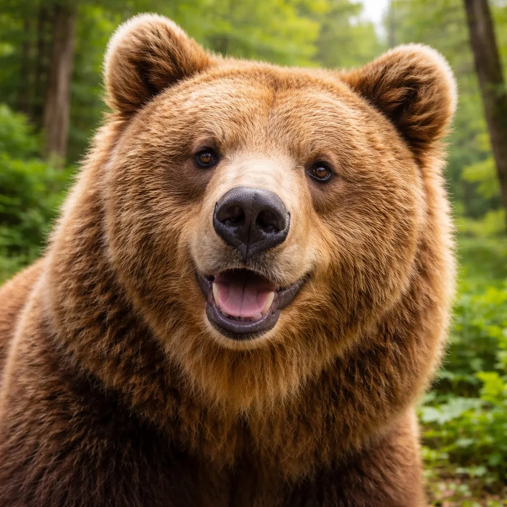
Kumamap Kumamap Kumamap
Map Areas Trip Planner Community Alerts Report
English 日本語 한국어 简体中文 繁體中文 ไทย
Sign in
Sign in
Map Areas Trip Planner Community Alerts Report
English 日本語 한국어 简体中文 繁體中文 ไทย
  1. Home
  2. Trip Planner
  3. Trip Reports
  4. Sapporo TV Tower to Shikisai-no-oka Hiking Route

Sapporo TV Tower to Shikisai-no-oka Hiking Route

Moderate Risk · 132 km · 1d 2h 29m · 2 stops · 1 sighting · Saved May 11, 2026 · Last updated 4 hours ago
0 views
0
Incidents in last 7 days
1
Incidents in last 30 days
1 month ago
Latest Incident

Safety Summary

This 132 km route from Sapporo TV Tower to Shikisai-no-oka crosses Hokkaido. Over the past 30 days, 1 bear sightings have been recorded within 5 km of the route, with no new activity in the past week. This route runs through brown bear habitat (native to Hokkaido). The most recent sighting was reported 1 month ago near Sapporo 米里, Hokkaido; the location sits about 5.7 km from the start of the route and 312 m off the route line.

With activity this close, make noise as you hike, carry bear spray, and avoid the forest at dawn and dusk.

Brown bears in Hokkaido are larger and more dangerous than mainland black bears. Exercise extreme caution.

Your Route

Route Profile

Highlights Along Your Route (5)

5 places within 1 km of your route, passing through Hokkaido.

JR Tower
Moderate Risk

JR Tower

Hokkaido

1,642 incidents

Sapporo TV Tower
Moderate Risk

Sapporo TV Tower

Hokkaido

1,653 incidents

Sapporo Clock Tower
Moderate Risk

Sapporo Clock Tower

Hokkaido

1,651 incidents

Sapporo Beer Museum
Moderate Risk

Sapporo Beer Museum

Hokkaido

1,529 incidents

Shikisai-no-oka
Low Risk

Shikisai-no-oka

Hokkaido

215 incidents

JR Tower
Moderate Risk

JR Tower

Hokkaido

1,642 incidents

Sapporo TV Tower
Moderate Risk

Sapporo TV Tower

Hokkaido

1,653 incidents

Sapporo Clock Tower
Moderate Risk

Sapporo Clock Tower

Hokkaido

1,651 incidents

Sapporo Beer Museum
Moderate Risk

Sapporo Beer Museum

Hokkaido

1,529 incidents

Shikisai-no-oka
Low Risk

Shikisai-no-oka

Hokkaido

215 incidents

Route Timeline

|
S
Sapporo TV Tower, Hokkaido
Moderate Risk 132 km 1d 2h 29m 1 sightings within 5 km

Around 19:00 on April 14, a person walking a dog sighted a bear-like animal about 80 cm long on the riverbed north of the Kita-Juusanjo Bridge on the Toyohira River in Yonesato, Shiroishi-ku, Sapporo. Police patrolled the area but found no footprints, droppings, or reports of damage; Sapporo City plans an on-site survey on April 15 and police will increase patrols during school commuting hours.

Sapporo 米里, Hokkaido

News ·1 month ago
G
Shikisai-no-oka, Hokkaido
Total Distance: 132 km

When Are Bears Most Active?

Peak activity at 19:00 with 1 incidents

Brown bears on your route

Hokkaido Brown Bear

Hokkaido Brown Bear

Ursus arctos yesoensis
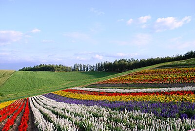
Range
Hokkaido
Size
200–400 kg
Active
Dawn & dusk

Sharing space safely

  • ·Make noise as you walk so they hear you coming
  • ·Carry bear spray; deploy at 5 m if charged
  • ·If contact happens, lie face down with fingers laced behind your neck. They typically disengage once you stop moving
  • ·Don't run, don't climb

Safety Checklist

Hiking in bear country

Safety picks and trail essentials, top-rated on Amazon and Rakuten.

Emergency Contacts

110
Police
119
Fire/Ambulance

For mountain rescue, call 110 (police). They will coordinate with local rescue teams.

Trip Report - Lake Biwa
Bear risk analysis map showing route with safety levels
Very High Risk
High Risk
Moderate Risk
Low Risk

Like what you see? Plan your own.

Draw any route in Japan and get the same bear-safety report, built around the trip you're actually taking.

  • Same incident database powering this report
  • Risk forecast tuned to your exact route
  • Free, instant, no sign-up
Plan my route Browse more trips

Comments (0)

0/2000

No comments yet.

Frequently Asked Questions About This Route

How many bear sightings are on this route?

Over the past 30 days, 1 bear sightings have been recorded within 5 km of this route, with no new activity in the past week. This route runs through brown bear habitat (native to Hokkaido).

When and where was the most recent bear sighting near this route?

The most recent sighting was reported 1 month ago near Sapporo 米里, Hokkaido; the location sits about 5.7 km from the start of the route and 312 m off the route line.

What time of day are bears most active here?

Recent sightings on this route peak around 19:00. Bears are generally most active at dawn and dusk.

Is this route safe to travel right now?

This 132 km route from Sapporo TV Tower to Shikisai-no-oka crosses Hokkaido. Over the past 30 days, 1 bear sightings have been recorded within 5 km of the route, with no new activity in the past week. This route runs through brown bear habitat (native to Hokkaido). The most recent sighting was reported 1 month ago near Sapporo 米里, Hokkaido; the location sits about 5.7 km from the start of the route and 312 m off the route line. With activity this close, make noise as you hike, carry bear spray, and avoid the forest at dawn and dusk.

Back to Trip Reports
Kumamap Kumamap

Track bear incidents across Japan. Stay safe outdoors.

Explore

Map Account Areas Predictions Near Me Trip Planner Trip Reports Community Alerts Gear

Learn

Bear Safety Guides Blog News Data FAQ

Mobile

iOS App Android App LINE WhatsApp

Company

About Contact Report Advertise

Legal

Privacy Terms Commercial Disclosure

Our Partners

mistweaverco.com
© 2026 Kumamap