Kumamap Kumamap Kumamap
Map Areas Trip Planner Sponsor Alerts Report
English 日本語 한국어 简体中文 繁體中文 ไทย
Sign in
Sign in
Map Areas Trip Planner Sponsor Alerts Report
English 日本語 한국어 简体中文 繁體中文 ไทย
  1. Home
  2. Iwate
  3. Hachimantai
  4. Entrance of Iwatesan Service Area (southbound Tohoku Expressway), Hachimantai City
Incident photo 1

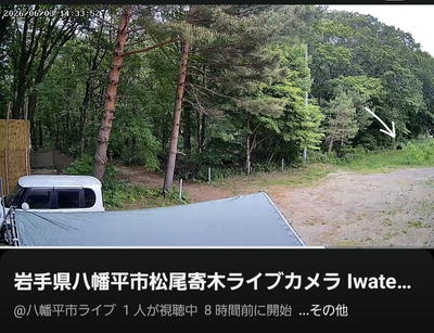
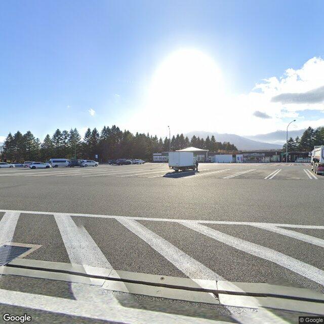
News 2 Black Bears Entrance of Iwatesan Service Area (southbound Tohoku Expressway), Hachimantai City, Iwate Nov 13, 2025, 12:00 PM

0 views
Saw one too? Report it

Location

Description

Following multiple bear sightings, the entrance to the Iwatesan Service Area on the southbound Tohoku Expressway in Hachimantai City was closed. The report describes the situation around noon on November 13.

Note: Official sources provide information in Japanese only. This description has been machine translated for your convenience.

Bear Type

Black Bear

Number of Bears

2

Provider Type

News

Date & Time

Thursday, November 13, 2025 at 12:00 PM

Address

Entrance of Iwatesan Service Area (southbound Tohoku Expressway), Hachimantai City, Iwate

Coordinates

39.913871, 141.046361

Sources

https://news.ntv.co.jp/n/tvi/category/society/tv5c136fbf2cc1...

Related Areas

Iwate
Very High Risk

Iwate

3,062 incidents

Mount Iwate
Low Risk

Mount Iwate

Iwate

60 incidents

Ou Mountains
Low Risk

Ou Mountains

Iwate

59 incidents

Hachimantai
Low Risk

Hachimantai

Iwate

49 incidents

Iwate
Very High Risk

Iwate

3,062 incidents

Mount Iwate
Low Risk

Mount Iwate

Iwate

60 incidents

Ou Mountains
Low Risk

Ou Mountains

Iwate

59 incidents

Hachimantai
Low Risk

Hachimantai

Iwate

49 incidents

Nearby places of interest

Mountain 3.2 km

Tateyama

館山

Iwate ·12 incidents

Mountain 3.6 km

Mt. Nodamori

Iwate ·12 incidents

Mountain 4.3 km

Atago Yama

愛宕山

Iwate ·12 incidents

Mountain 4.5 km

San Tsu Moriyama

三ッ森山

Iwate ·12 incidents

Mountain 4.8 km

Mt. Tateyama

Iwate ·11 incidents

Mountain 3.2 km

Tateyama

館山

Iwate ·12 incidents

Mountain 3.6 km

Mt. Nodamori

Iwate ·12 incidents

Mountain 4.3 km

Atago Yama

愛宕山

Iwate ·12 incidents

Mountain 4.5 km

San Tsu Moriyama

三ッ森山

Iwate ·12 incidents

Mountain 4.8 km

Mt. Tateyama

Iwate ·11 incidents

Comments (0)

0/2000

No comments yet.

Plan Your Trip Risk Map

Hiking in bear country

Safety picks and trail essentials, top-rated on Amazon and Rakuten.

Nearby Incidents

Hachimantai 田頭, Iwate
News

Hachimantai 田頭, Iwate

3.0 km

3 weeks ago

News

Matsuo Junior High School (Hachimantai), Iwate

3.1 km

7 months ago

Official

Hachimantai Matsubara, Iwate

3.9 km

3 years ago

Noda, Hachimantai, Iwate, Iwate
News

Noda, Hachimantai, Iwate, Iwate

4.1 km

7 months ago

Hachimantai 田頭, Iwate
News

Hachimantai 田頭, Iwate

4.2 km

2 weeks ago

Official

Hachimantai Yamamichi, Iwate

4.7 km

2 years ago

Official

Hachimantai Yamamichi, Iwate

4.8 km

2 years ago

Hachimantai, Iwate
Community

Hachimantai, Iwate

5.0 km

3 weeks ago

Hachimantai 田頭, Iwate
News

Hachimantai 田頭, Iwate

3.0 km

3 weeks ago

News

Matsuo Junior High School (Hachimantai), Iwate

3.1 km

7 months ago

Official

Hachimantai Matsubara, Iwate

3.9 km

3 years ago

Noda, Hachimantai, Iwate, Iwate
News

Noda, Hachimantai, Iwate, Iwate

4.1 km

7 months ago

Hachimantai 田頭, Iwate
News

Hachimantai 田頭, Iwate

4.2 km

2 weeks ago

Official

Hachimantai Yamamichi, Iwate

4.7 km

2 years ago

Official

Hachimantai Yamamichi, Iwate

4.8 km

2 years ago

Hachimantai, Iwate
Community

Hachimantai, Iwate

5.0 km

3 weeks ago

Kumamap Kumamap

Track bear incidents across Japan. Stay safe outdoors.

Explore

Map Account Areas Places of Interest Predictions Near Me Trip Planner Trip Reports Community Alerts Gear

Learn

Bear Safety Guides Blog News Data FAQ

Mobile

iOS App Android App LINE WhatsApp

Company

About Contact Report Sponsor

Legal

Privacy Terms Commercial Disclosure
© 2026 Kumamap