Kumamap Kumamap Kumamap
Map Areas Trip Planner Sponsor Alerts Report
English 日本語 한국어 简体中文 繁體中文 ไทย
Sign in
Sign in
Map Areas Trip Planner Sponsor Alerts Report
English 日本語 한국어 简体中文 繁體中文 ไทย
  1. Home
  2. Gunma
  3. Numata
  4. Numata Shirasawamachi-Iwamuro

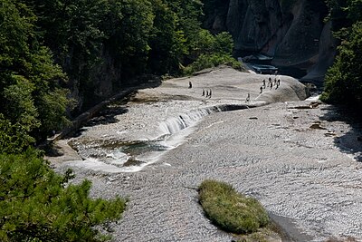
Official Black Bear Numata Shirasawamachi-Iwamuro, Gunma Aug 27, 2024, 01:40 PM

0 views
Saw one too? Report it

Location

Description

No description provided

Bear Type

Black Bear

Number of Bears

1

Provider Type

Official

Date & Time

Tuesday, August 27, 2024 at 01:40 PM

Address

Numata Shirasawamachi-Iwamuro, Gunma

Coordinates

36.653188, 139.162177

Sources

https://pref-gunma.maps.arcgis.com/apps/dashboards/5276d2ebf...

Related Areas

Gunma
Very High Risk

Gunma

1,637 incidents

Marble Village Lockheart Castle
Moderate Risk

Marble Village Lockheart Castle

Gunma

602 incidents

Kichijō-ji Temple
Moderate Risk

Kichijō-ji Temple

Gunma

537 incidents

Watarase River
Low Risk

Watarase River

Tochigi

316 incidents

Fukiware Falls
Low Risk

Fukiware Falls

Gunma

305 incidents

Numata
Low Risk

Numata

Gunma

190 incidents

Mount Akagi
Low Risk

Mount Akagi

Gunma

113 incidents

Gunma
Very High Risk

Gunma

1,637 incidents

Marble Village Lockheart Castle
Moderate Risk

Marble Village Lockheart Castle

Gunma

602 incidents

Kichijō-ji Temple
Moderate Risk

Kichijō-ji Temple

Gunma

537 incidents

Watarase River
Low Risk

Watarase River

Tochigi

316 incidents

Fukiware Falls
Low Risk

Fukiware Falls

Gunma

305 incidents

Numata
Low Risk

Numata

Gunma

190 incidents

Mount Akagi
Low Risk

Mount Akagi

Gunma

113 incidents

Comments (0)

0/2000

No comments yet.

Plan Your Trip Risk Map

Hiking in bear country

Safety picks and trail essentials, top-rated on Amazon and Rakuten.

Nearby Incidents

Official

Numata Shirasawamachi-Namae, Gunma

643 m

1 year ago

Official

Numata Tonemachi-Sonohara, Gunma

1.4 km

2 years ago

Official

Numata Tonemachi-Sonohara, Gunma

1.4 km

10 months ago

Official

Numata Tonemachi-Wakumi, Gunma

1.5 km

9 months ago

Official

Numata Tonemachi-Sonohara, Gunma

1.7 km

1 year ago

Official

Numata Shirasawamachi-Oai, Gunma

2.0 km

1 year ago

Official

Numata Tonemachi-Wakumi, Gunma

2.0 km

1 year ago

Official

Numata Tonemachi-Aoki, Gunma

2.1 km

11 months ago

Official

Numata Shirasawamachi-Namae, Gunma

643 m

1 year ago

Official

Numata Tonemachi-Sonohara, Gunma

1.4 km

2 years ago

Official

Numata Tonemachi-Sonohara, Gunma

1.4 km

10 months ago

Official

Numata Tonemachi-Wakumi, Gunma

1.5 km

9 months ago

Official

Numata Tonemachi-Sonohara, Gunma

1.7 km

1 year ago

Official

Numata Shirasawamachi-Oai, Gunma

2.0 km

1 year ago

Official

Numata Tonemachi-Wakumi, Gunma

2.0 km

1 year ago

Official

Numata Tonemachi-Aoki, Gunma

2.1 km

11 months ago

Kumamap Kumamap

Track bear incidents across Japan. Stay safe outdoors.

Explore

Map Account Areas Places of Interest Predictions Near Me Trip Planner Trip Reports Community Alerts Gear

Learn

Bear Safety Guides Blog News Data FAQ

Mobile

iOS App Android App LINE WhatsApp

Company

About Contact Report Sponsor

Legal

Privacy Terms Commercial Disclosure
© 2026 Kumamap