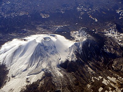
Kumamap Kumamap Kumamap
Map Areas Trip Planner Sponsor Alerts Report
English 日本語 한국어 简体中文 繁體中文 ไทย
Sign in
Sign in
Map Areas Trip Planner Sponsor Alerts Report
English 日本語 한국어 简体中文 繁體中文 ไทย
  1. Home
  2. Gunma
  3. Naganohara

Official Black Bear Naganohara, Gunma Jun 15, 2026, 07:30 AM

0 views
Saw one too? Report it

Location

Description

No description provided

Bear Type

Black Bear

Number of Bears

1

Provider Type

Official

Date & Time

Monday, June 15, 2026 at 07:30 AM

Address

Naganohara, Gunma

Coordinates

36.468675, 138.608031

Sources

https://pref-gunma.maps.arcgis.com/apps/dashboards/5276d2ebf...

Related Areas

Gunma
Very High Risk

Gunma

1,620 incidents

Yanba Dam
High Risk

Yanba Dam

Gunma

493 incidents

Kusatsu Onsen
High Risk

Kusatsu Onsen

Gunma

426 incidents

Jōshin'etsu-kōgen National Park
High Risk

Jōshin'etsu-kōgen National Park

Gunma

408 incidents

Mount Asama
High Risk

Mount Asama

Gunma

297 incidents

Asama insan
High Risk

Asama insan

Gunma

251 incidents

Naganohara
Moderate Risk

Naganohara

Gunma

74 incidents

Gunma
Very High Risk

Gunma

1,620 incidents

Yanba Dam
High Risk

Yanba Dam

Gunma

493 incidents

Kusatsu Onsen
High Risk

Kusatsu Onsen

Gunma

426 incidents

Jōshin'etsu-kōgen National Park
High Risk

Jōshin'etsu-kōgen National Park

Gunma

408 incidents

Mount Asama
High Risk

Mount Asama

Gunma

297 incidents

Asama insan
High Risk

Asama insan

Gunma

251 incidents

Naganohara
Moderate Risk

Naganohara

Gunma

74 incidents

Nearby places of interest

Hotel 955 m

Seven Resorts Kitakaruizawa

Gunma ·21 incidents

Waterfall 2.1 km

Uodome Falls

Gunma ·20 incidents

Waterfall 2.3 km

Asama Great Falls

Gunma ·19 incidents

Mountain 4.3 km

Mt. Asamakakushi

Gunma ·28 incidents

Mountain 4.6 km

Koma Kami Yama

駒髪山

Gunma ·27 incidents

Hotel 955 m

Seven Resorts Kitakaruizawa

Gunma ·21 incidents

Waterfall 2.1 km

Uodome Falls

Gunma ·20 incidents

Waterfall 2.3 km

Asama Great Falls

Gunma ·19 incidents

Mountain 4.3 km

Mt. Asamakakushi

Gunma ·28 incidents

Mountain 4.6 km

Koma Kami Yama

駒髪山

Gunma ·27 incidents

Comments (0)

0/2000

No comments yet.

Plan Your Trip Risk Map

Hiking in bear country

Safety picks and trail essentials, top-rated on Amazon and Rakuten.

Nearby Incidents

Official

Naganohara, Gunma

30 m

1 week ago

Official

Naganohara, Gunma

213 m

1 week ago

Official

Naganohara Kitakaruizawa, Gunma

287 m

1 week ago

Naganohara Kitakaruizawa, Gunma
Official

Naganohara Kitakaruizawa, Gunma

536 m

7 months ago

Official

Naganohara, Gunma

610 m

12 hours ago

Official

Naganohara, Gunma

710 m

7 months ago

Official

Naganohara, Gunma

763 m

7 months ago

Official

Naganohara Kitakaruizawa, Gunma

1.2 km

1 month ago

Official

Naganohara, Gunma

30 m

1 week ago

Official

Naganohara, Gunma

213 m

1 week ago

Official

Naganohara Kitakaruizawa, Gunma

287 m

1 week ago

Naganohara Kitakaruizawa, Gunma
Official

Naganohara Kitakaruizawa, Gunma

536 m

7 months ago

Official

Naganohara, Gunma

610 m

12 hours ago

Official

Naganohara, Gunma

710 m

7 months ago

Official

Naganohara, Gunma

763 m

7 months ago

Official

Naganohara Kitakaruizawa, Gunma

1.2 km

1 month ago

Kumamap Kumamap

Track bear incidents across Japan. Stay safe outdoors.

Explore

Map Account Areas Places of Interest Predictions Near Me Trip Planner Trip Reports Community Alerts Gear

Learn

Bear Safety Guides Blog News Data FAQ

Mobile

iOS App Android App LINE WhatsApp

Company

About Contact Report Sponsor

Legal

Privacy Terms Commercial Disclosure
© 2026 Kumamap