Kumamap Kumamap Kumamap
Map Areas Trip Planner Sponsor Alerts Report
English 日本語 한국어 简体中文 繁體中文 ไทย
Sign in
Sign in
Map Areas Trip Planner Sponsor Alerts Report
English 日本語 한국어 简体中文 繁體中文 ไทย
  1. Home
  2. Iwate
  3. Morioka
  4. Morioka Higashikuroishino 3-chome
Incident photo 1

Official Black Bear Morioka Higashikuroishino 3-chome, Iwate Mar 3, 2026, 07:00 PM

0 views
Saw one too? Report it

Location

Description

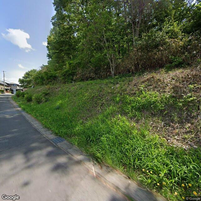
Saw a bear near the hot spring facility.

Note: Official sources provide information in Japanese only. This description has been machine translated for your convenience.

Bear Type

Black Bear

Number of Bears

1

Provider Type

Official

Date & Time

Tuesday, March 3, 2026 at 07:00 PM

Address

Morioka Higashikuroishino 3-chome, Iwate

Coordinates

39.747235, 141.155994

Sources

https://www.google.com/maps/d/u/0/viewer?mid=1QnVCL8lSy4tc9b...

Related Areas

Iwate
Very High Risk

Iwate

3,062 incidents

Morioka
Very High Risk

Morioka

Iwate

1,655 incidents

Morioka Castle
Very High Risk

Morioka Castle

Iwate

1,649 incidents

Iwate Museum of Art
Very High Risk

Iwate Museum of Art

Iwate

1,620 incidents

Iwate
Very High Risk

Iwate

3,062 incidents

Morioka
Very High Risk

Morioka

Iwate

1,655 incidents

Morioka Castle
Very High Risk

Morioka Castle

Iwate

1,649 incidents

Iwate Museum of Art
Very High Risk

Iwate Museum of Art

Iwate

1,620 incidents

Nearby places of interest

Park 130 m

Higashi Kuroishi No Doriimu Kouen

東黒石野ドリーム公園

Iwate ·79 incidents

Park 137 m

Higashi Kuroishi No Fureai Kouen

東黒石野ふれあい公園

Iwate ·67 incidents

Hospital 253 m

Shouen Daiichi Byouin

松園第一病院

Iwate ·234 incidents

Bus Terminal 272 m

Shouen Basutaaminaru

松園バスターミナル

Iwate ·224 incidents

Park 325 m

Kuroishi No Paakutaun Jidoukouen

黒石野パークタウン児童公園

Iwate ·71 incidents

Mountain 379 m

Oomori Yama

大森山

Iwate ·821 incidents

Park 383 m

Higashi Kuroishi No Kouen

東黒石野公園

Iwate ·89 incidents

Park 426 m

Kojika Kouen

小鹿公園

Iwate ·81 incidents

Comments (0)

0/2000

No comments yet.

Plan Your Trip Risk Map

Hiking in bear country

Safety picks and trail essentials, top-rated on Amazon and Rakuten.

Nearby Incidents

Morioka Higashikuroishino 3-chome, Iwate
Official

Morioka Higashikuroishino 3-chome, Iwate

0 m

3 months ago

Official

Morioka Higashikuroishino 2-chome, Iwate

68 m

11 months ago

News

Nishimatsuzono 1-chome, Morioka City (city road east of Matsuzono Bus Terminal), Iwate

254 m

7 months ago

Official

Morioka Higashikuroishino 2-chome, Iwate

258 m

7 months ago

Official

Morioka Higashikuroishino 2-chome, Iwate

258 m

7 months ago

Official

Morioka Higashikuroishino 3-chome, Iwate

281 m

1 year ago

Official

Morioka Higashikuroishino 3-chome, Iwate

284 m

11 months ago

Official

Morioka Nishimatsuzono 1-chome, Iwate

284 m

7 months ago

Morioka Higashikuroishino 3-chome, Iwate
Official

Morioka Higashikuroishino 3-chome, Iwate

0 m

3 months ago

Official

Morioka Higashikuroishino 2-chome, Iwate

68 m

11 months ago

News

Nishimatsuzono 1-chome, Morioka City (city road east of Matsuzono Bus Terminal), Iwate

254 m

7 months ago

Official

Morioka Higashikuroishino 2-chome, Iwate

258 m

7 months ago

Official

Morioka Higashikuroishino 2-chome, Iwate

258 m

7 months ago

Official

Morioka Higashikuroishino 3-chome, Iwate

281 m

1 year ago

Official

Morioka Higashikuroishino 3-chome, Iwate

284 m

11 months ago

Official

Morioka Nishimatsuzono 1-chome, Iwate

284 m

7 months ago

Kumamap Kumamap

Track bear incidents across Japan. Stay safe outdoors.

Explore

Map Account Areas Places of Interest Predictions Near Me Trip Planner Trip Reports Community Alerts Gear

Learn

Bear Safety Guides Blog News Data FAQ

Mobile

iOS App Android App LINE WhatsApp

Company

About Contact Report Sponsor

Legal

Privacy Terms Commercial Disclosure
© 2026 Kumamap