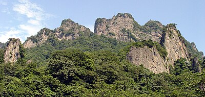
Kumamap Kumamap Kumamap
Map Areas Trip Planner Sponsor Alerts Report
English 日本語 한국어 简体中文 繁體中文 ไทย
Sign in
Sign in
Map Areas Trip Planner Sponsor Alerts Report
English 日本語 한국어 简体中文 繁體中文 ไทย
  1. Home
  2. Gunma
  3. Nammoku
  4. Oshiozawa

Official Black Bear Oshiozawa, Gunma May 28, 2026, 03:00 PM

0 views
Saw one too? Report it

Location

Description

No description provided

Bear Type

Black Bear

Number of Bears

1

Provider Type

Official

Date & Time

Thursday, May 28, 2026 at 03:00 PM

Address

Oshiozawa, Gunma

Coordinates

36.201680, 138.713841

Sources

https://pref-gunma.maps.arcgis.com/apps/dashboards/5276d2ebf...

Related Areas

Gunma
High Risk

Gunma

1,550 incidents

Usui Pass Railway Heritage Park
Moderate Risk

Usui Pass Railway Heritage Park

Gunma

421 incidents

Nakanotake Shrine
Moderate Risk

Nakanotake Shrine

Gunma

362 incidents

Myōgi-Arafune-Saku Kōgen Quasi-National Park
Moderate Risk

Myōgi-Arafune-Saku Kōgen Quasi-National Park

Gunma

204 incidents

The Tomioka Silk Mill and Related Industrial Heritage
Low Risk

The Tomioka Silk Mill and Related Industrial Heritage

Gunma

158 incidents

Tomioka Silk Mill
Low Risk

Tomioka Silk Mill

Gunma

158 incidents

Mount Myōgi
Low Risk

Mount Myōgi

Gunma

157 incidents

Mount Arafune
Low Risk

Mount Arafune

Gunma

86 incidents

Gunma
High Risk

Gunma

1,550 incidents

Usui Pass Railway Heritage Park
Moderate Risk

Usui Pass Railway Heritage Park

Gunma

421 incidents

Nakanotake Shrine
Moderate Risk

Nakanotake Shrine

Gunma

362 incidents

Myōgi-Arafune-Saku Kōgen Quasi-National Park
Moderate Risk

Myōgi-Arafune-Saku Kōgen Quasi-National Park

Gunma

204 incidents

The Tomioka Silk Mill and Related Industrial Heritage
Low Risk

The Tomioka Silk Mill and Related Industrial Heritage

Gunma

158 incidents

Tomioka Silk Mill
Low Risk

Tomioka Silk Mill

Gunma

158 incidents

Mount Myōgi
Low Risk

Mount Myōgi

Gunma

157 incidents

Mount Arafune
Low Risk

Mount Arafune

Gunma

86 incidents

Nearby places of interest

Mountain 1.1 km

Shika Gaku

鹿岳

Gunma ·12 incidents

Mountain 1.9 km

Kurotaki Yama

黒滝山

Gunma ·15 incidents

Mountain 2.1 km

Mt. Yottsumata

Gunma ·14 incidents

Mountain 3.2 km

Monogatari Yama

物語山

Gunma ·13 incidents

Mountain 3.2 km

Mt. Fuji-Asama

Gunma ·15 incidents

Mountain 1.1 km

Shika Gaku

鹿岳

Gunma ·12 incidents

Mountain 1.9 km

Kurotaki Yama

黒滝山

Gunma ·15 incidents

Mountain 2.1 km

Mt. Yottsumata

Gunma ·14 incidents

Mountain 3.2 km

Monogatari Yama

物語山

Gunma ·13 incidents

Mountain 3.2 km

Mt. Fuji-Asama

Gunma ·15 incidents

Comments (0)

0/2000

No comments yet.

Plan Your Trip Risk Map

Hiking in bear country

Safety picks and trail essentials, top-rated on Amazon and Rakuten.

Nearby Incidents

Official

Oshiozawa, Gunma

2.1 km

2 years ago

Official

Ozawa, Gunma

3.4 km

2 weeks ago

Official

Ozawa, Gunma

3.5 km

2 years ago

Official

Ozawa, Gunma

3.5 km

2 years ago

Official

Ozawa, Gunma

3.5 km

2 years ago

Official

Shimonita Town Higashinomaki, Gunma

3.7 km

1 year ago

Official

Iwado, Gunma

3.9 km

2 years ago

Official

Shimonita Town Higashinomaki, Gunma

4.1 km

1 year ago

Official

Oshiozawa, Gunma

2.1 km

2 years ago

Official

Ozawa, Gunma

3.4 km

2 weeks ago

Official

Ozawa, Gunma

3.5 km

2 years ago

Official

Ozawa, Gunma

3.5 km

2 years ago

Official

Ozawa, Gunma

3.5 km

2 years ago

Official

Shimonita Town Higashinomaki, Gunma

3.7 km

1 year ago

Official

Iwado, Gunma

3.9 km

2 years ago

Official

Shimonita Town Higashinomaki, Gunma

4.1 km

1 year ago

Kumamap Kumamap

Track bear incidents across Japan. Stay safe outdoors.

Explore

Map Account Areas Places of Interest Predictions Near Me Trip Planner Trip Reports Community Alerts Gear

Learn

Bear Safety Guides Blog News Data FAQ

Mobile

iOS App Android App LINE WhatsApp

Company

About Contact Report Sponsor

Legal

Privacy Terms Commercial Disclosure
© 2026 Kumamap