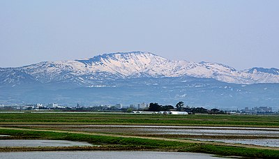
Kumamap Kumamap Kumamap
Map Areas Trip Planner Sponsor Alerts Report
English 日本語 한국어 简体中文 繁體中文 ไทย
Sign in
Sign in
Map Areas Trip Planner Sponsor Alerts Report
English 日本語 한국어 简体中文 繁體中文 ไทย
  1. Home
  2. Yamagata
  3. Takahata
  4. Takahata 大字馬頭

Official Black Bear Takahata 大字馬頭, Yamagata May 25, 2026, 05:00 AM

0 views
Saw one too? Report it

Location

Description

Environment: Farmland / Size: Adult

Note: Official sources provide information in Japanese only. This description has been machine translated for your convenience.

Bear Type

Black Bear

Number of Bears

1

Provider Type

Official

Date & Time

Monday, May 25, 2026 at 05:00 AM

Address

Takahata 大字馬頭, Yamagata

Coordinates

37.948072, 140.180847

Sources

https://v2.kemonote.com/#/map

Related Areas

Yamagata
Very High Risk

Yamagata

9,092 incidents

Yonezawa Castle
High Risk

Yonezawa Castle

Yamagata

1,543 incidents

Kumano Shrine
Moderate Risk

Kumano Shrine

Yamagata

1,284 incidents

Takahata
Low Risk

Takahata

Yamagata

137 incidents

Yamagata
Very High Risk

Yamagata

9,092 incidents

Yonezawa Castle
High Risk

Yonezawa Castle

Yamagata

1,543 incidents

Kumano Shrine
Moderate Risk

Kumano Shrine

Yamagata

1,284 incidents

Takahata
Low Risk

Takahata

Yamagata

137 incidents

Nearby places of interest

Mountain 3.0 km

Ichinen-bo

Yamagata ·407 incidents

Airport 4.1 km

Yonezawa Heripooto

米沢ヘリポート

Yamagata ·514 incidents

Mountain 3.0 km

Ichinen-bo

Yamagata ·407 incidents

Airport 4.1 km

Yonezawa Heripooto

米沢ヘリポート

Yamagata ·514 incidents

Comments (0)

0/2000

No comments yet.

Plan Your Trip Risk Map

Hiking in bear country

Safety picks and trail essentials, top-rated on Amazon and Rakuten.

Nearby Incidents

Official

Takahata 大字馬頭, Yamagata

348 m

10 months ago

Official

Takahata 大字馬頭, Yamagata

348 m

10 months ago

Official

Takahata 大字馬頭, Yamagata

348 m

10 months ago

Official

Takahata 大字佐沢, Yamagata

657 m

1 month ago

Official

Takahata 大字佐沢, Yamagata

771 m

11 months ago

Official

Takahata 大字佐沢, Yamagata

771 m

11 months ago

Official

Takahata 大字佐沢, Yamagata

771 m

11 months ago

Official

Takahata 大字佐沢, Yamagata

998 m

5 years ago

Official

Takahata 大字馬頭, Yamagata

348 m

10 months ago

Official

Takahata 大字馬頭, Yamagata

348 m

10 months ago

Official

Takahata 大字馬頭, Yamagata

348 m

10 months ago

Official

Takahata 大字佐沢, Yamagata

657 m

1 month ago

Official

Takahata 大字佐沢, Yamagata

771 m

11 months ago

Official

Takahata 大字佐沢, Yamagata

771 m

11 months ago

Official

Takahata 大字佐沢, Yamagata

771 m

11 months ago

Official

Takahata 大字佐沢, Yamagata

998 m

5 years ago

Kumamap Kumamap

Track bear incidents across Japan. Stay safe outdoors.

Explore

Map Account Areas Places of Interest Predictions Near Me Trip Planner Trip Reports Community Alerts Gear

Learn

Bear Safety Guides Blog News Data FAQ

Mobile

iOS App Android App LINE WhatsApp

Company

About Contact Report Sponsor

Legal

Privacy Terms Commercial Disclosure
© 2026 Kumamap