Kumamap Kumamap Kumamap
Map Areas Trip Planner Sponsor Alerts Report
English 日本語 한국어 简体中文 繁體中文 ไทย
Sign in
Sign in
Map Areas Trip Planner Sponsor Alerts Report
English 日本語 한국어 简体中文 繁體中文 ไทย
  1. Home
  2. Fukushima
  3. Otama
Incident photo 1

Official Black Bear Otama, Fukushima Jun 24, 2026, 08:30 PM

0 views
Saw one too? Report it

Location

Description

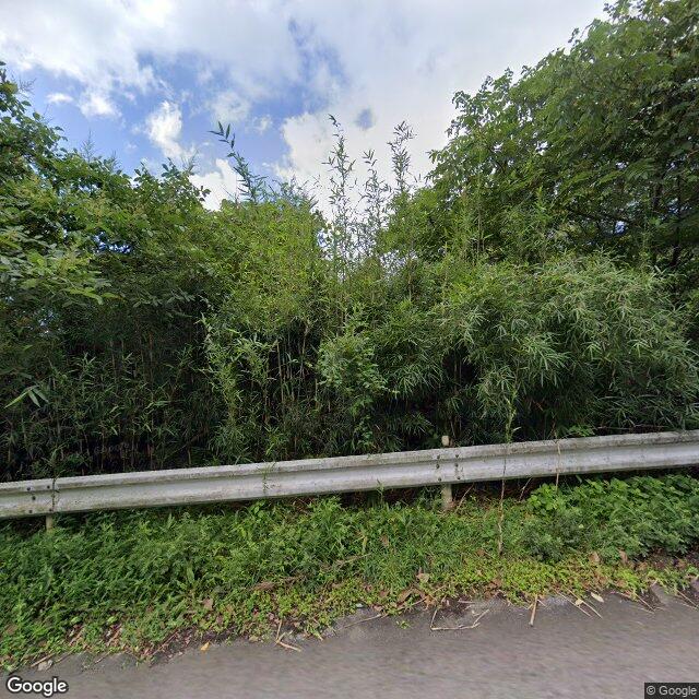
On Thursday, June 25 at about 5:30 a.m., in a forested area of Oyama Osarakubo, Otama Village, a witness (male in his 70s) observed one bear (approximately 1 meter in body length) walking along the woodland near nearby houses. The bear then left into the forest.

Note: Official sources provide information in Japanese only. This description has been machine translated for your convenience.

Bear Type

Black Bear

Number of Bears

1

Provider Type

Official

Date & Time

Wednesday, June 24, 2026 at 08:30 PM

Address

Otama, Fukushima

Coordinates

37.573040, 140.346668

Sources

https://www.rfc.jp/spe/kuma/

Related Areas

Fukushima
Very High Risk

Fukushima

6,289 incidents

Nihonmatsu Castle
High Risk

Nihonmatsu Castle

Fukushima

1,125 incidents

Mount Adatara
Moderate Risk

Mount Adatara

Fukushima

542 incidents

Otama
Low Risk

Otama

Fukushima

73 incidents

Fukushima
Very High Risk

Fukushima

6,289 incidents

Nihonmatsu Castle
High Risk

Nihonmatsu Castle

Fukushima

1,125 incidents

Mount Adatara
Moderate Risk

Mount Adatara

Fukushima

542 incidents

Otama
Low Risk

Otama

Fukushima

73 incidents

Nearby places of interest

Hotel 240 m

Ootama Onsen Kanaizumi Kaku

大玉温泉 金泉閣

Fukushima ·60 incidents

Mountain 2.8 km

Odaka Kurayama

小高倉山

Fukushima ·94 incidents

Mountain 3.9 km

San Tsu Moriyama

三ツ森山

Fukushima ·100 incidents

Mountain 4.7 km

Komae Ke Gaku

小前ヶ岳

Fukushima ·77 incidents

Hotel 240 m

Ootama Onsen Kanaizumi Kaku

大玉温泉 金泉閣

Fukushima ·60 incidents

Mountain 2.8 km

Odaka Kurayama

小高倉山

Fukushima ·94 incidents

Mountain 3.9 km

San Tsu Moriyama

三ツ森山

Fukushima ·100 incidents

Mountain 4.7 km

Komae Ke Gaku

小前ヶ岳

Fukushima ·77 incidents

Comments (0)

0/2000

No comments yet.

Plan Your Trip Risk Map

Hiking in bear country

Safety picks and trail essentials, top-rated on Amazon and Rakuten.

Nearby Incidents

Official

Otama, Fukushima

67 m

2 months ago

Official

Otama 大皿久保, Fukushima

70 m

7 months ago

Official

Otama 大皿久保, Fukushima

76 m

3 years ago

Official

Otama 大皿久保, Fukushima

107 m

9 months ago

News

Otama 大皿久保, Fukushima

111 m

2 months ago

Official

Otama 大皿久保, Fukushima

136 m

8 months ago

Otama, Fukushima
Official

Otama, Fukushima

190 m

1 day ago

Official

Otama 大皿久保, Fukushima

200 m

2 years ago

Official

Otama, Fukushima

67 m

2 months ago

Official

Otama 大皿久保, Fukushima

70 m

7 months ago

Official

Otama 大皿久保, Fukushima

76 m

3 years ago

Official

Otama 大皿久保, Fukushima

107 m

9 months ago

News

Otama 大皿久保, Fukushima

111 m

2 months ago

Official

Otama 大皿久保, Fukushima

136 m

8 months ago

Otama, Fukushima
Official

Otama, Fukushima

190 m

1 day ago

Official

Otama 大皿久保, Fukushima

200 m

2 years ago

Kumamap Kumamap

Track bear incidents across Japan. Stay safe outdoors.

Explore

Map Account Areas Places of Interest Predictions Near Me Trip Planner Trip Reports Community Alerts Gear

Learn

Bear Safety Guides Blog News Data FAQ

Mobile

iOS App Android App LINE WhatsApp

Company

About Contact Report Sponsor

Legal

Privacy Terms Commercial Disclosure
© 2026 Kumamap