Location
Description
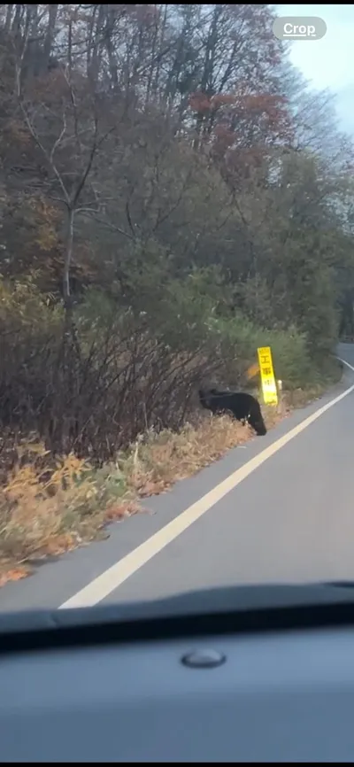
Crossing the road.
Note: Official sources provide information in Japanese only. This description has been machine translated for your convenience.
Bear Type
Black Bear
Number of Bears
1
Provider Type
Official
Date & Time
Friday, August 11, 2023 at 06:00 PM
Address
Semboku, Akita
Coordinates
39.987070, 140.747040
Sources
Related Areas

Nearby places of interest
Mountain 1.9 km
San Tsu Mata Mori
三ツ又森
Akita ·16 incidents
Waterfall 2.5 km
So Ri Taki
曽利滝
Akita ·16 incidents
Mountain 2.7 km
Mt. Akita-Yakeyama
Akita ·32 incidents
Mountain 3.0 km
Mt. Shibakura
Akita ·15 incidents
Mountain 3.0 km
Yokomori
横森
Akita ·37 incidents
Mountain 3.2 km
Mt. Tsugamori
Akita ·37 incidents
Mountain 3.5 km
Kiku Mori
椈森
Akita ·15 incidents
Mountain 3.9 km
Mikata Taka
三方高
Akita ·18 incidents
Comments (0)
No comments yet.
Hiking in bear country
Safety picks and trail essentials, top-rated on Amazon and Rakuten.