
สถานที่
คำอธิบาย
Descending from Midorigaoka toward the Forestry Cooperative area; near an intersection it came out of the grass onto the road, crossed, and went into the grass toward the Forestry Cooperative
ประเภทหมี
หมีดำ
จำนวนหมี
1
ประเภทผู้ให้ข้อมูล
ทางการ
วันที่และเวลา
วันเสาร์ที่ 6 กรกฎาคม 2567 เวลา 16:40
ที่อยู่
Kitaakita Bozawa, Akita
พิกัด
40.206046, 140.335710
แหล่งที่มา
พื้นที่ที่เกี่ยวข้อง

สถานที่ใกล้เคียง
ซากปราสาท 1.1 km
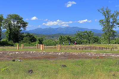
Ise Dou Tai Iseki
伊勢堂岱遺跡
จังหวัดอาคิตะ ·122 เหตุการณ์
สถานีรถไฟ 1.2 km
Jomon-Ogata
จังหวัดอาคิตะ ·109 เหตุการณ์
พิพิธภัณฑ์ 1.4 km
Ise Dou Tai Joumon Kan
伊勢堂岱縄文館
จังหวัดอาคิตะ ·72 เหตุการณ์
ภูเขา 2.4 km
Kanisawa Yama
蟹沢山
จังหวัดอาคิตะ ·443 เหตุการณ์
สนามบิน 3.4 km
Odate-Noshiro Airport
จังหวัดอาคิตะ ·554 เหตุการณ์
ความคิดเห็น (0)
ยังไม่มีความคิดเห็น
อุปกรณ์เดินป่าในญี่ปุ่น
อุปกรณ์รับมือหมีและเดินป่า คะแนนสูงบน Amazon และ Rakuten